An initiative of the Anteaters and Highways project monitored 15% of highways in Mato Grosso do Sul, Brazil, for 3 years, where 425 tapirs, 766 giant anteaters, and 968 capybaras were recorded dead during this period. ICAS researchers warn of the importance of mitigation measures to avoid inevitable tragedy, and a new study indicates the most critical points where there is a risk of wildlife-vehicle collisions.
The study, conducted by researchers from ICAS – Wild Animal Conservation Institute and published in the scientific journal Austral Ecology, by Wiley (Australia), analyzed data from a survey carried out between 2017 and 2020 in Mato Grosso do Sul (MS), Brazil.
This resulted in the recording of 2,159 carcasses of large wild animals, more specifically tapirs, giant anteaters, and capybaras that died from vehicle collisions. A frightening number that shows the risk to everyone’s lives.
The collection of this data occurred in only 15% of the paved highways in the state, which means, if the numbers were extended to all the roads in Mato Grosso do Sul and even more so to the rest of Brazil, the impact of this issue would be much greater and even more alarming, demonstrating the need for and importance of implementing a variety of mitigation measures.
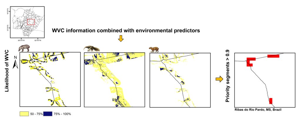
With a master’s in forest resources, the first author of the article, Yuri Ribeiro, explains that the research revealed indications/predictions about the most critical points on roads and highways throughout the territory of MS through spatial models.
To arrive at this result, this researcher used ecologically based information, in other words, the variables that evaluate land use, distance from rivers, and topography of the region, in addition to collision data collected through the Anteaters and Highways project, administered by ICAS, over a period of 3 years, covering about 2,000 kilometers of highway in MS.
“We took this data and performed risk prediction for the state’s paved and unpaved road system. This made it possible to map the most critical points and where mitigation measures would be most efficient at protecting the lives of people and animals. This study shows that wildlife-vehicle collisions are not simply fatalities. Rather they are accidents waiting to happen,” he explains.
Research methodology
The first step of the study was to understand the distribution of vehicle collisions with the three species that represent the greatest risk to human safety and that are deeply impacted and often hit in MS. Subsequently, we identified the characteristics of the surroundings, such as, the distribution of areas of native vegetation, the presence of rivers, streams, rough terrain, altitude, among other information. Large-scale data analysis was conducted around roads, resulting in the modeling of the probability of the occurrence of these animals and the risk of collisions with each of them along the highways.

According to ICAS’s founder, Arnaud Desbiez, the monitoring of these highways served as the basis for modeling this new study, which classified a large stretch of the road network in MS as a priority for mitigation. As such, this research offers important information with the aim of providing better road safety for people and biodiversity.
“There needs to be a dialogue between the different public and private sectors, research institutions, and civil society to arrive at a consensus on prioritization, especially with regard to improving the environmental licensing process, which must, necessarily, include scientifically based information and guidance on where mitigation measures should be implemented first,” the president of ICAS stressed.
"This study shows that wildlife-vehicle collisions are not simply fatalities. Rather they are accidents waiting to happen."
Public policy
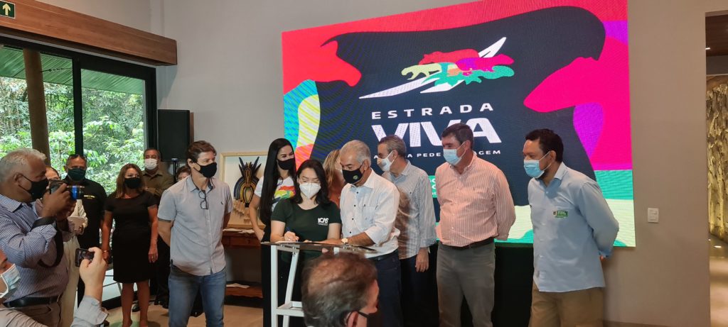
In addition to this study, ICAS researchers have disseminated the data to different sectors of society. The team participates in events and meetings involving the concession and privatization of roads and highways, starting with BR-163, which is currently under discussion as proposed by Brazil’s National Land Transport Agency (ANTT).
The stretch of road that is being discussed is called “Rota Pantanal” (the “Pantanal Route”) and extends for 379.6 kilometers, from its junction with BR-262, in Campo Grande (MS, Brazil), to the end of Ponte Rio Correntes (Rio Correntes Bridge), on the MS border with Mato Grosso. This stretch also has a high rate of wildlife-vehicle collisions and several critical points for the implementation of mitigation measures.
On December 17th, 2021, we released the “Manual de Orientações Técnicas para Mitigação de Colisões Veiculares com Fauna Silvestre nas Rodovias Estaduais do Mato Grosso do Sul” (“Manual of Technical Guidelines for Mitigating Wildlife-Vehicle Collisions on State Highways in Mato Grosso do Sul”), an ICAS publication developed in partnership with the Secretariat of Infrastructure for the State of Mato Grosso do Sul (SEINFRA), the State Agency for Enterprises in Mato Grosso do Sul (AGESUL), the
Institute of the Environment of Mato Grosso do Sul (IMASUL), and the State University of Mato Grosso do Sul (UEMS).
The publication of this manual, as an act of public policy, was an important step forward in mitigating wildlife-vehicle collisions. However, to actually achieve these results, the guidelines contained in this material must be implemented urgently.


